The challenge: a 15-year-old baseline no longer reflected current land conditions
Afghanistan’s most recent comprehensive national land cover baseline was produced in 2010. Since then, agricultural expansion, settlement growth, climate variability and prolonged conflict have altered the landscape across northern Afghanistan. Development and disaster risk programmes therefore needed a more current, spatially detailed evidence base for planning and targeting.
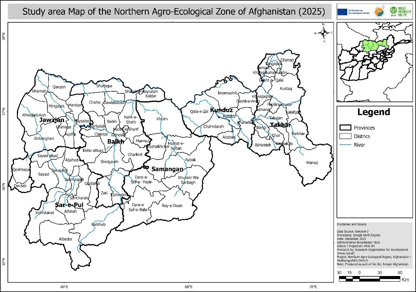
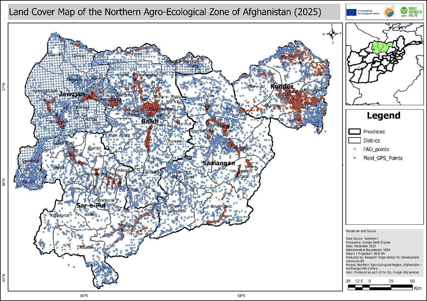
The client commissioned an updated 2025 land use and land cover dataset for the northern agro-ecological region, covering terrain from the irrigated Amu Darya plains to the Hindu Kush foothills. The land cover component was designed to support programme targeting, agricultural value-chain work and disaster risk analysis.
How we mapped the landscape
LSGA applied a multi-temporal, multi-sensor classification workflow on Google Earth Engine. Seasonal optical imagery was combined with radar, terrain and other geospatial data to separate classes more clearly and to stay comparable with the FAO Land Cover Classification System (LCCS).
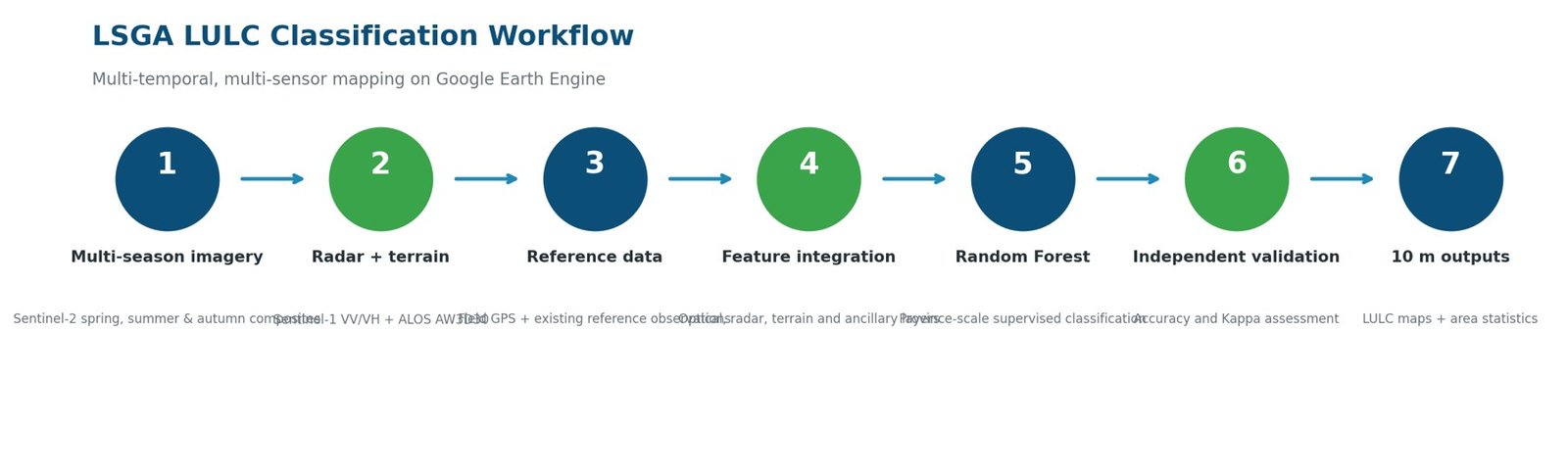
| Optical | Radar | Terrain and context |
|---|---|---|
| Sentinel-2 composites for spring, summer and autumn | Sentinel-1 SAR backscatter (VV and VH) | ALOS AW3D30 elevation, plus built-up and cropland layers |
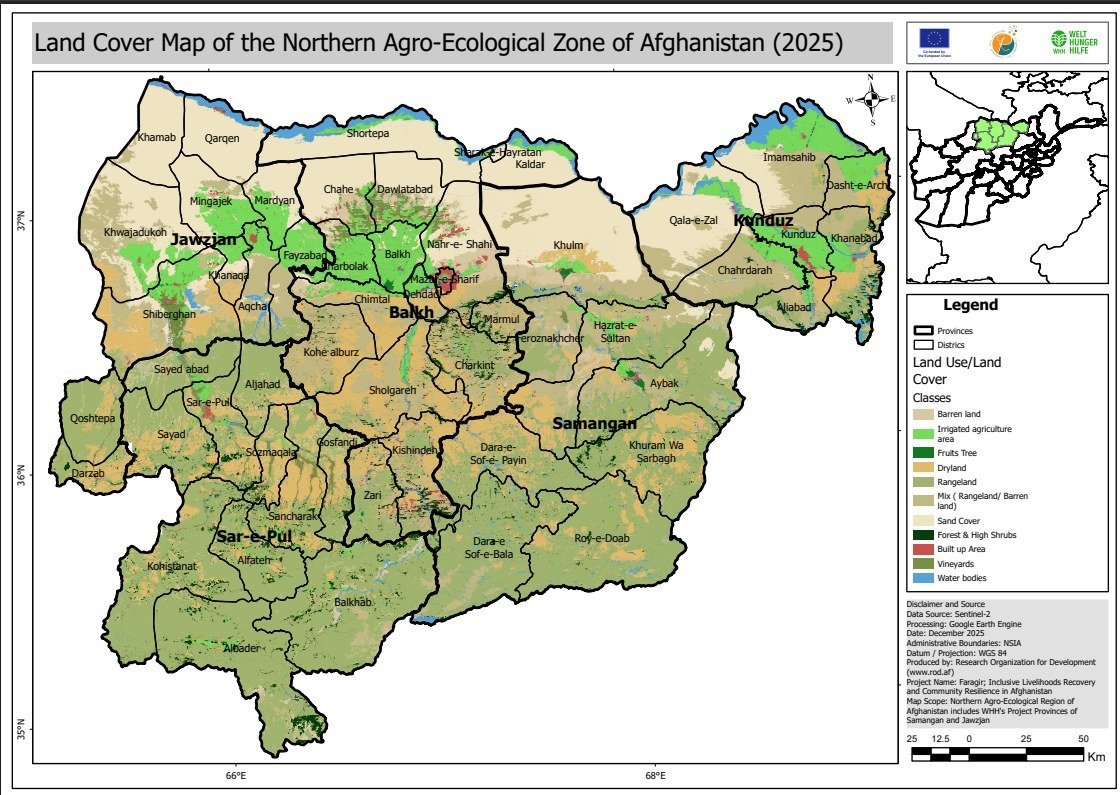
Classification framework & main result: 2025 land cover map
The final scheme has 11 land cover classes aligned with the FAO LCCS 2010 framework, so the 2025 results stay comparable with the national baseline and can be used for future change detection:
- Farmland: irrigated agriculture, rainfed agriculture, fruit trees, vineyards.
- Natural land and other: rangeland, mixed rangeland and barren, forest and shrubs, sand, barren land, water, built-up areas.
The classified output gives a current 10 m land cover view of the northern agro-ecological region. The final map separates 11 classes and is the spatial basis for province-level area statistics and further programme analysis.
Accuracy and validation
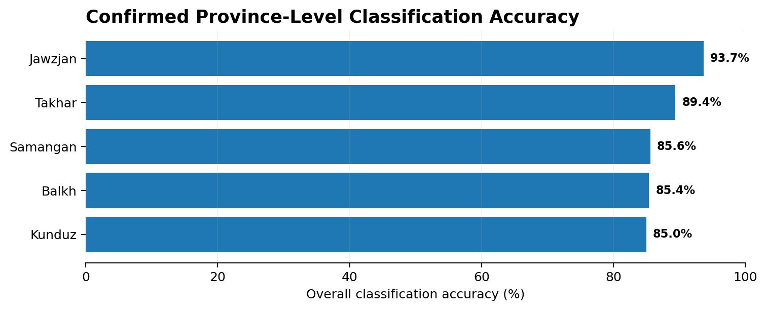
Independent reference observations were used to test classification performance. Overall accuracy by province: Jawzjan 93.7%, Takhar 89.4%, Samangan 85.6%, Balkh 85.4% and Kunduz 85.0%. Validation stays visible on this page because it shows how reliable the classification is, and where semi-arid transitional classes are harder to separate.
What the landscape contains
Beyond accuracy, the classification measures how much of each land cover class each province holds.
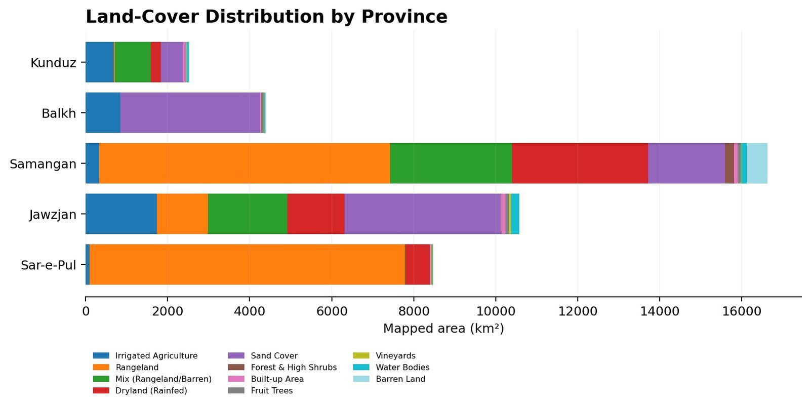
| Samangan rangeland | Jawzjan irrigated agriculture | Balkh sand cover | Samangan rainfed agriculture |
|---|---|---|---|
| 7,094 km² | 1,733 km² | 3,413 km² | 3,319 km² |
From maps to decisions
| Use | What the data supports |
|---|---|
| Agricultural targeting | Identify irrigated, rainfed and productive agricultural landscapes. |
| Natural resource assessment | Quantify rangeland, vegetation, barren land and water resources. |
| Disaster risk planning | Provide updated exposure and land surface information for risk analysis. |
| Programme monitoring | Set a current baseline for future land cover change assessment. |
Quality, validation and limitations
Classification performance varied across the study area, because some semi-arid land cover classes have similar spectral responses. Transitional areas between rangeland, barren surfaces and shrub vegetation are especially hard to separate consistently. Independent validation was used to measure this uncertainty and to show where results need careful interpretation.
Technology: Google Earth Engine · Sentinel-2 · Sentinel-1 SAR · ALOS AW3D30 · Random Forest · GIS · Remote sensing · Field GPS