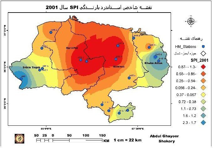
Drought Assessment
20 years · 5 drought indicators · 7 severe drought years
Twenty years of drought mapped from rainfall, land surface temperature, snow cover and vegetation condition.
Read more →Land Sensing Geospatial Analytics
Examples of our work: satellite analysis, verified in the field, delivered as maps and figures that support decisions.
Click any pin on the map to view the project summary and open the full case study.
Twenty years of drought mapped from rainfall, land surface temperature, snow cover and vegetation condition.
Read more →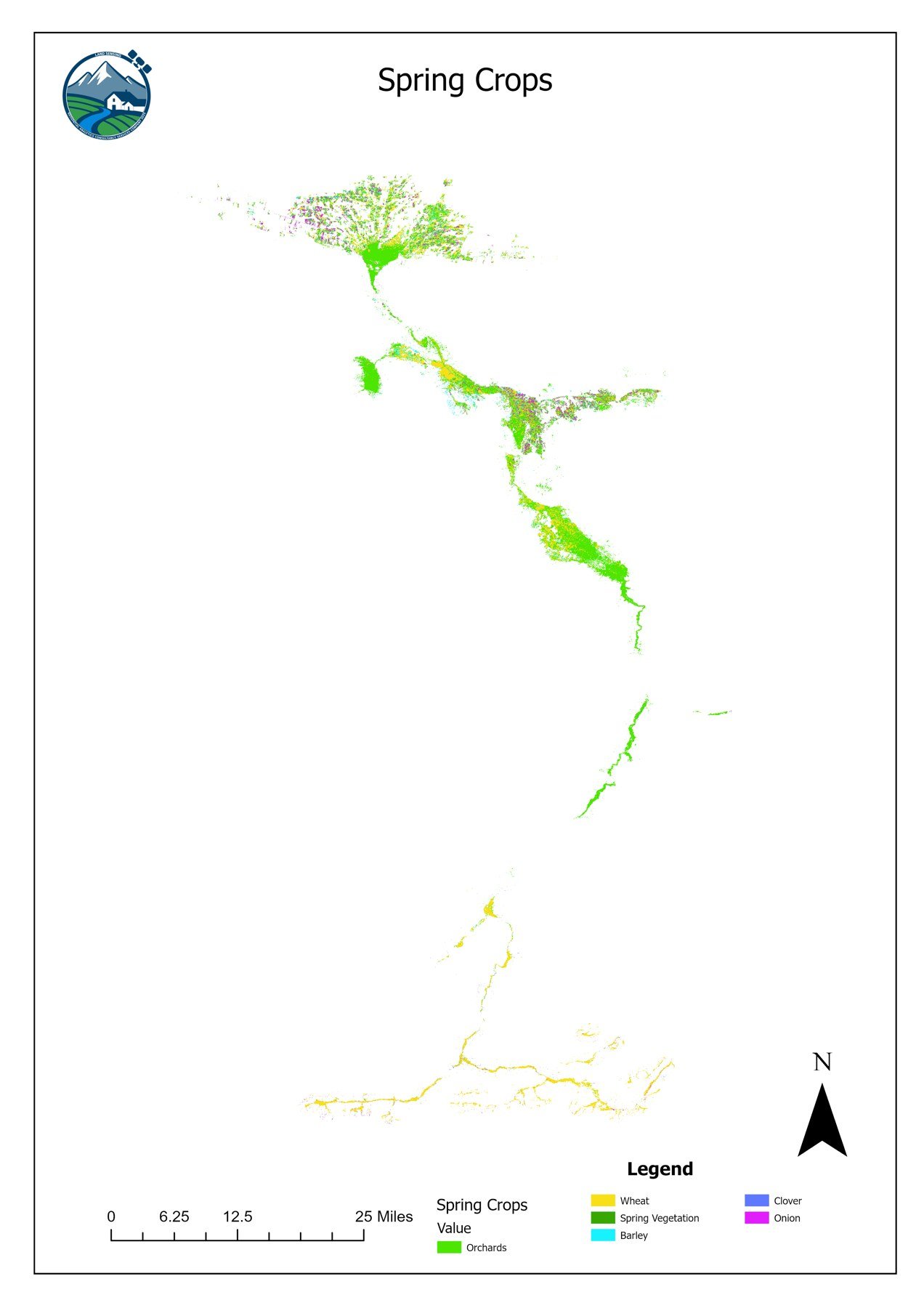
Separate spring and summer crop maps from satellite time series, machine learning and field observations.
Read more →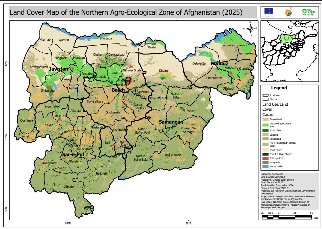
A current land cover map of northern Afghanistan, replacing the national baseline from 2010.
Read more →Get in touch
Tell us what you need to know, and we will propose how to answer it.